
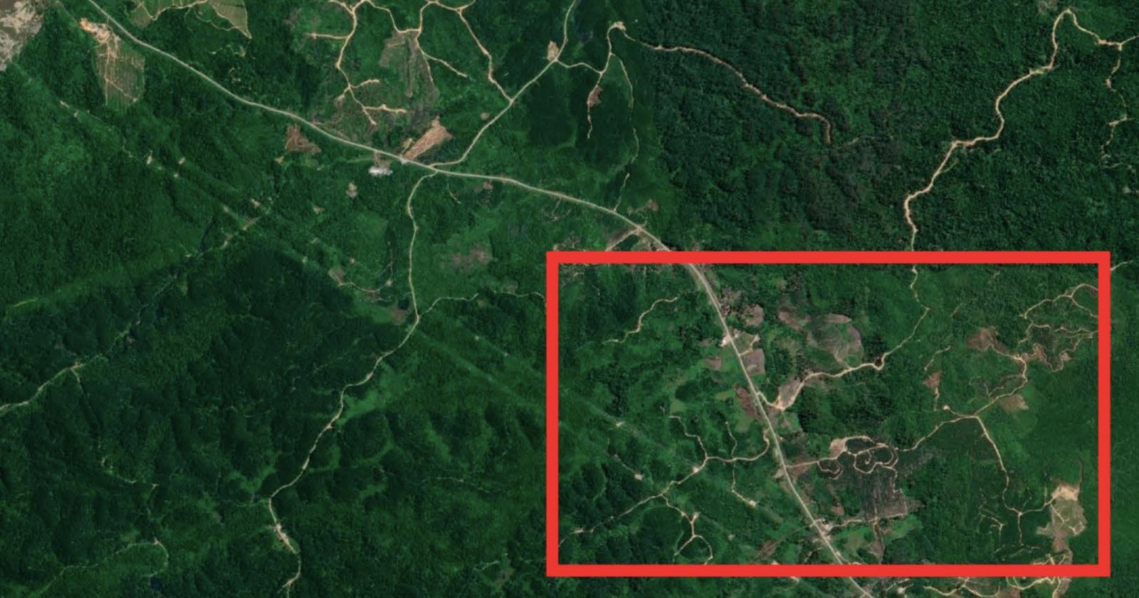
Satellite Photos and AI Combine to Reveal Secret Roads Damaging Rainforests
Scientists used AI to analyze satellite images and find the secret, unmapped roads that are destroying rainforests.
[Read More]
petapixel.com »Satellite - Последние новости [ Фото в новостях ] | |
Scientists used AI to analyze satellite images and find the secret, unmapped roads that are destroying rainforests.
[Read More]
petapixel.com »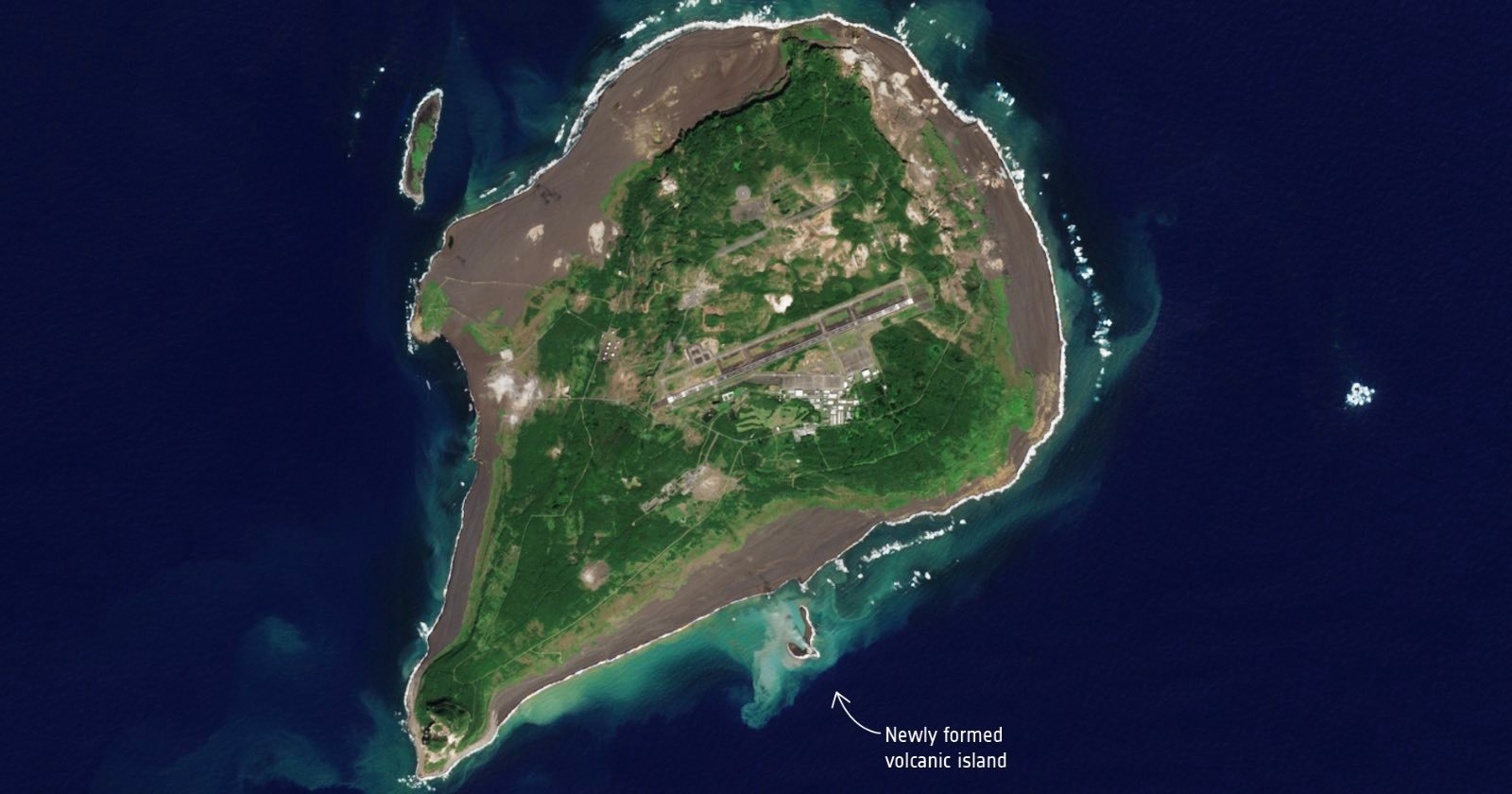
The "Earth's newest island" can be seen growing from space in newly-released satellite photos.
[Read More]
petapixel.com »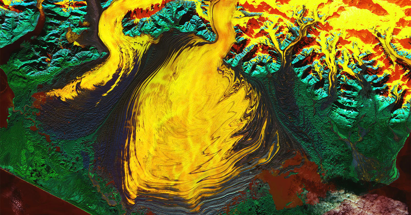
A new satellite image released by NASA reveals a psychedelic look at a hidden lagoon in a massive Alaskan glacier. However, the incredible photo also paints a worrying picture. [Read More] petapixel.com »
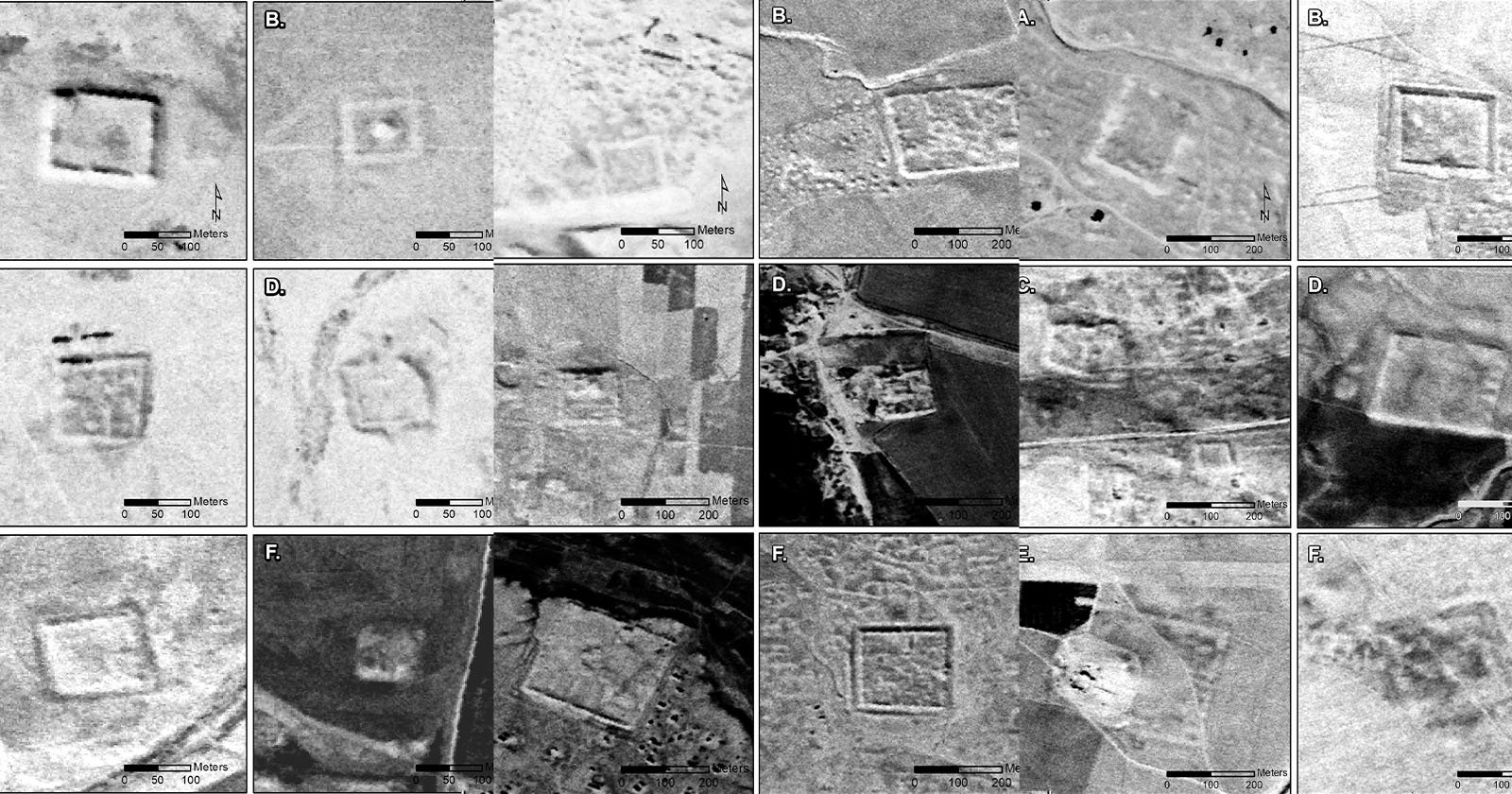
A declassified Central Intelligence Agency (CIA) satellite spy program has turned up hundreds of photos of ancient Roman forts in the Middle East -- challenging a theory that is decades old. [Read More] petapixel.com »
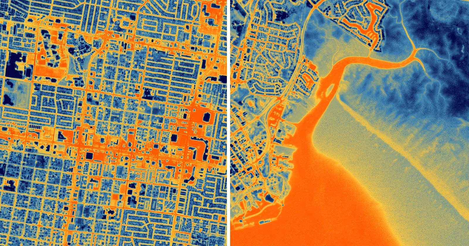
A new high-resolution thermal satellite camera has beamed back its first set of spectacular images.
[Read More]
petapixel.com »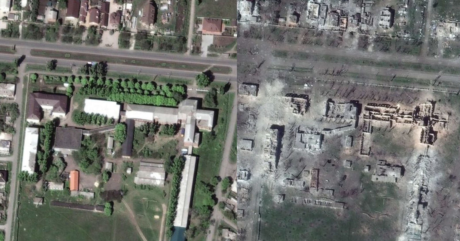
Fresh satellite images of the embattled Ukrainian city of Bakhmut lays bare the awful destruction that war has brought to the region. [Read More] petapixel.com »
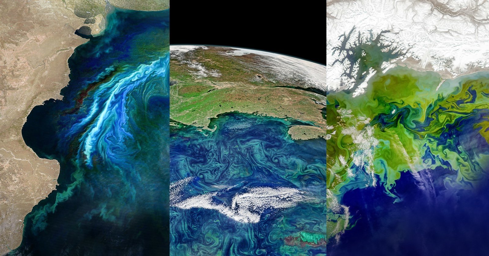
Striking satellite photos taken from space reveal how the earth's toxic algae blooms dramatically increased as the climate warmed. [Read More] petapixel.com »
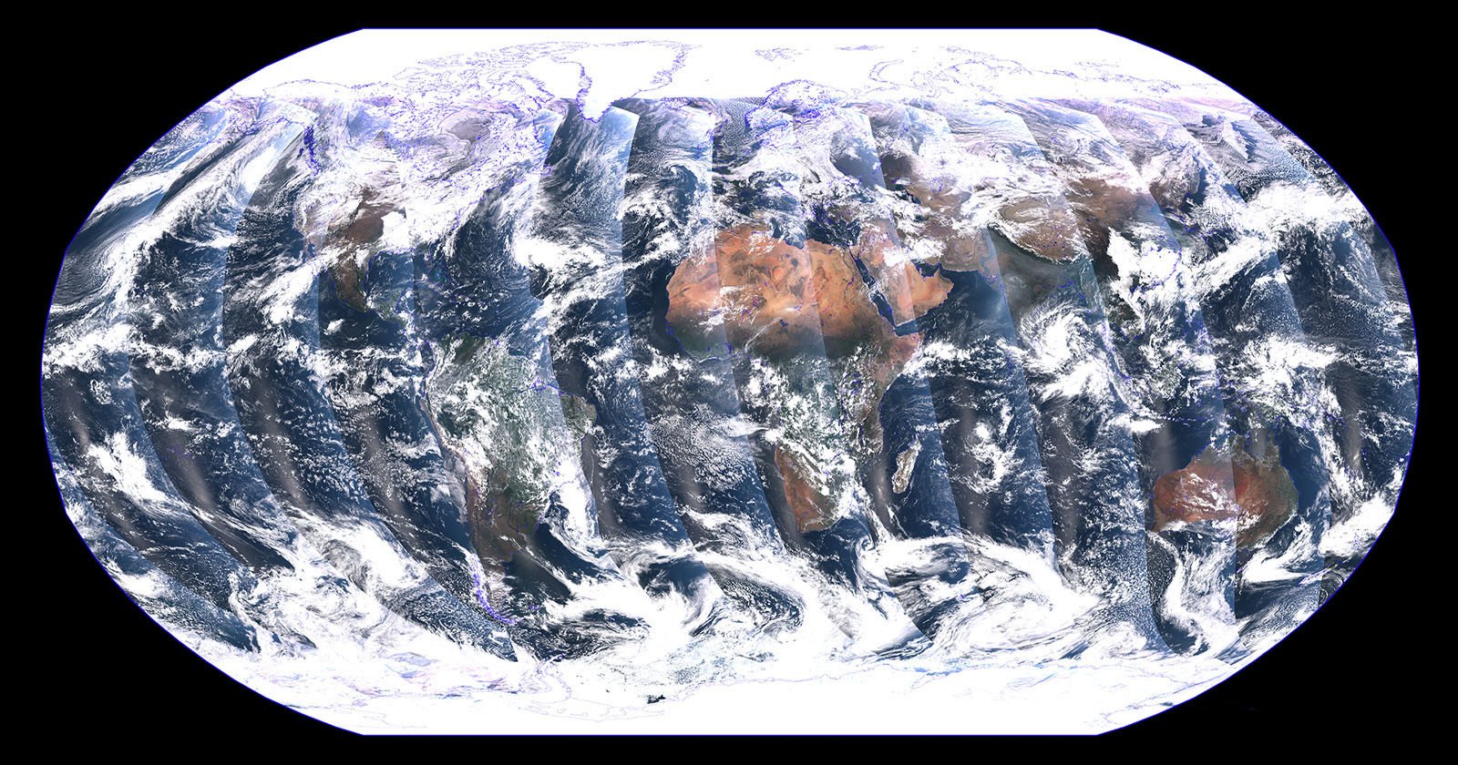
A recently launched NASA satellite has sent back this stunning mosaic image of Earth, captured over a 24-hour period.
[Read More]
petapixel.com »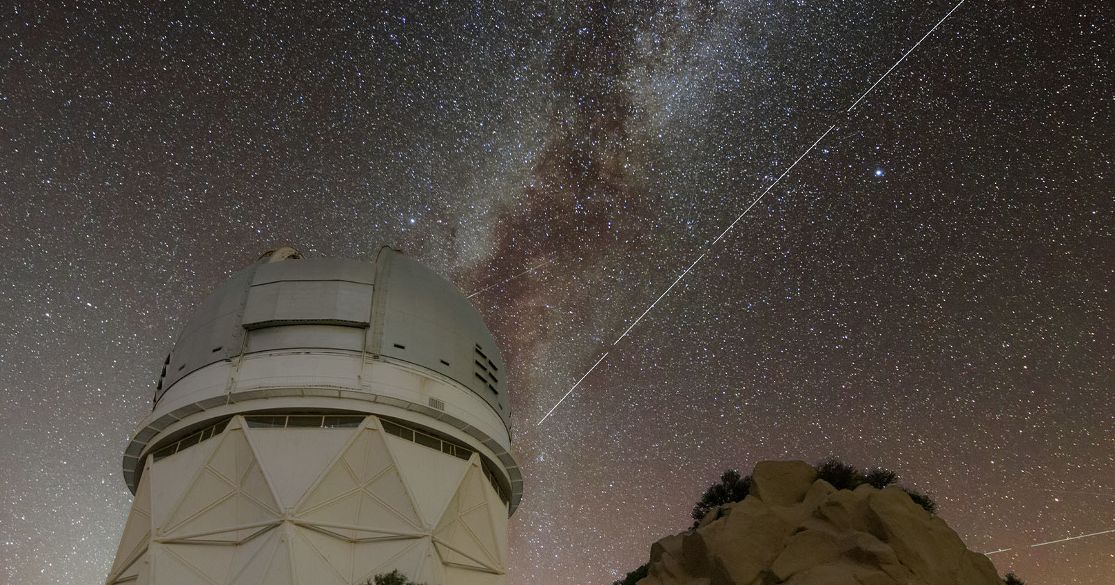
Astronomers have raised concerns over a new satellite that is now one of the brightest objects in the night sky that could also hinder astrophotographers. [Read More] petapixel.com »
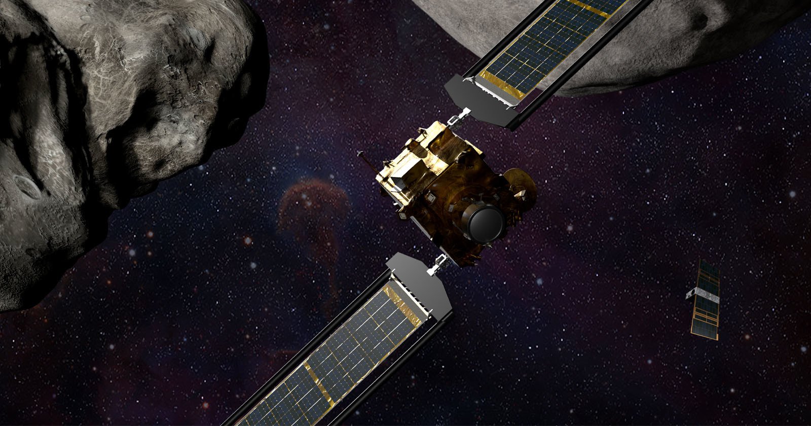
NASA's Double Asteroid Redirection Test (DART) is the world's first planetary defense test mission and it has deployed a smaller "mini photographer" spacecraft that will record all of the details of its planned impact with an asteroid. [Read More] petapixel.com »
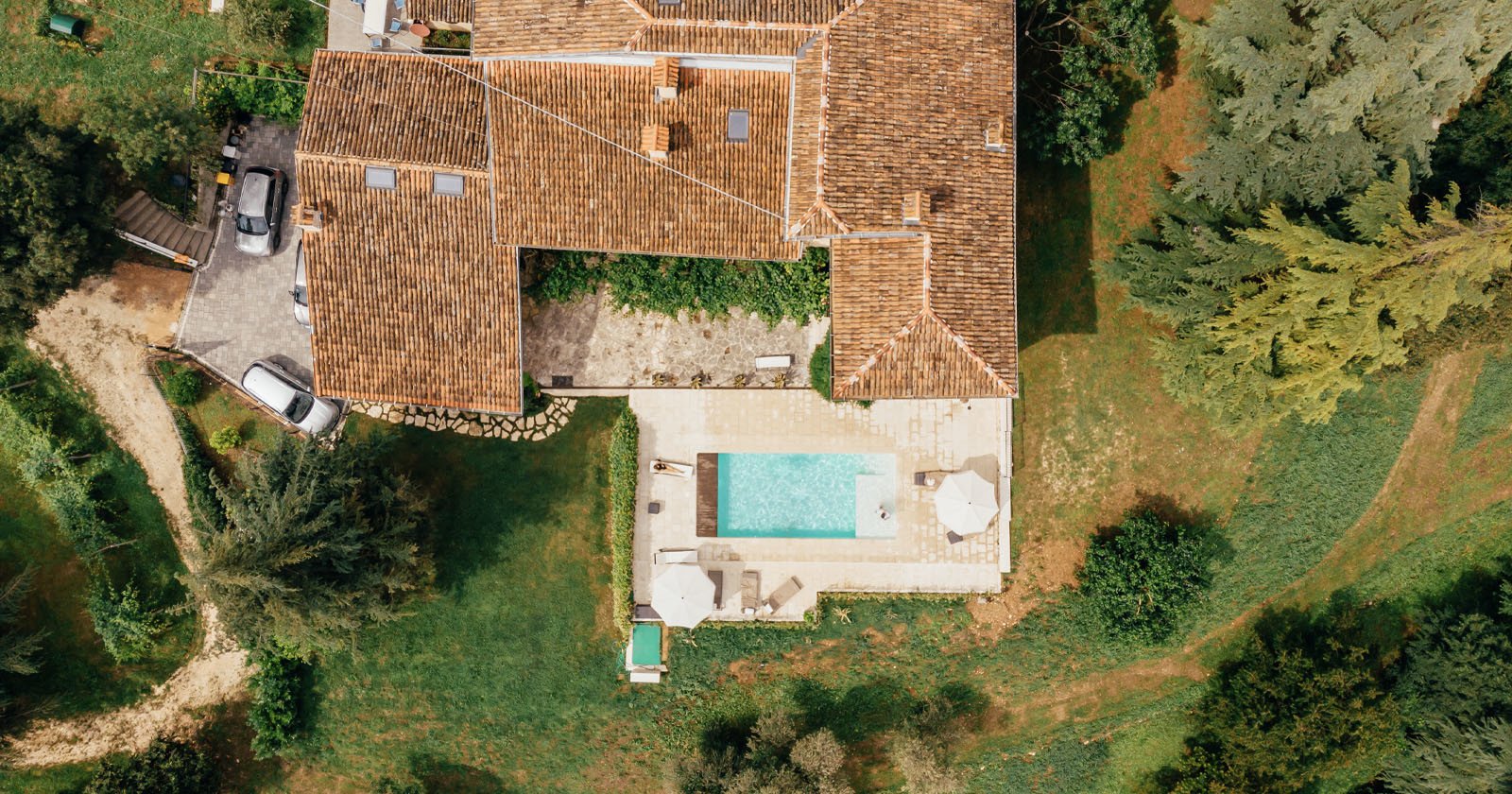
France is estimated to have about 3.2 million private swimming pools, but many of them are unregistered. Authorities are using satellite photos and AI to find them to recover about €10 million in unpaid taxes. [Read More] petapixel.com »
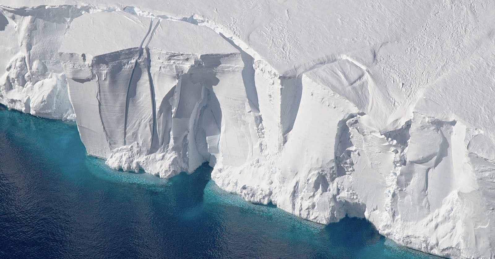
New research on Antarctica found in two separate studies that reference multiple optical and radar satellite sensors has revealed that the ice loss in Antarctica is much worse than previous estimates. [Read More] petapixel.com »
From the construction of a public park in Manhattan to the Yarlung Tsangpo River changing course on the Tibetan Plateau, the Daily Overview uses satellite imagery to create stunning images that detail how the world is changing. [Read More] petapixel.com »
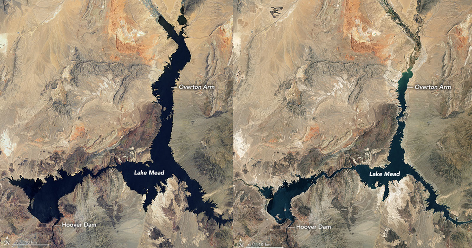
NASA has revealed dramatic photos that show water levels retreating in Lake Mead which is critical to both the supply of water and electricity across the southwestern United States. petapixel.com »
NanoAvionics sent a satellite into space with a selfie stick attached to a GoPro, which then transmitted back the world's first spacecraft selfie in 4K. [Read More] petapixel.com »

The Pentax DA* 300mm F4 ED(IF) SDM lens has gone to space. Ricoh Imaging Japan announced that its 300mm F4 lens for APS-C cameras has been installed in the Kitsune 6U CubeSat satellite as a shooting lens. dpreview.com »
Last year, Microsoft announced Azure Space, making the powerful Azure cloud ecosystem available to the space community. Today, Microsoft has announced new partnerships and capabilities for Azure Space, including innovations such as SpaceEye, which allows users to 'see' through clouds from satellites. dpreview.com »
Китай открыл новое государственное предприятие, которое создаст "ответ» на Starlink — интернет-проект Илона Маска. То есть Китай намерен запустить собственный глобальный спутниковый интернет. Перед молодой компанией China Satellite Network Group поставлена задача запускать в космос на низкую околоземную орбиту (НОО) спутники, которые будут предоставлять интернет-услуги в любой точке планеты. photorealm.ru »
Fake, AI-generated satellite images can pose threat to nations and agencies worldwide, a team of researchers warns. These bogus images could be used to create hoaxes ranging from natural disasters to propping up other fake news, or even be used to mislead international governments into conflicts. petapixel.com »

Lead image: San Jose as captured by the Canon CE-SAT-1. Image courtesy of Canon. Click to enlarge. Canon didn't announce any new products at this year's CES, but the company is leveraging an older product to give people the chance to capture simulated photos from distinct perspectives. dpreview.com »
If we mention the word Corona today, we'd be referring to the virus. That's just the way of common vernacular. In the early 1970s, though, the word meant something different to the CIA. Corona was the name of a spy satellite. thephoblographer.com »

SpaceX plans to launch thousands of satellites into space for the firm's Starlink high-speed satellite internet network. While the Starlink service aims to bring high-speed internet to locations where it is otherwise unavailable or prohibitively expensive, Independent is reporting that hundreds of astronomers have expressed concerns that Starlink's satellite array will have an impact on astronomy and slow down scientific discoveries. dpreview.com »
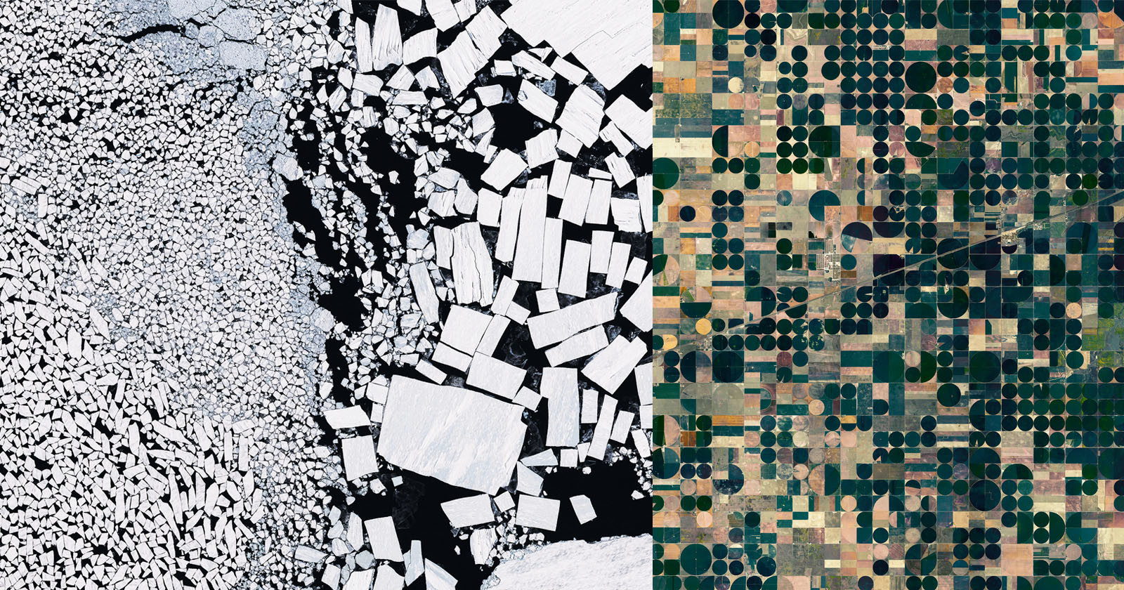
I’m fascinated by what our planet looks like from above. Natural textures, colors, and patterns, as well as human-made structures rife with symmetry, proportion, and design. Here are some from my ongoing project. boredpanda.com »
This past weekend, Canon was planning to launch its 5D Mark III-based CE-SAT 1B satellite camera into orbit, but it was not meant to be. The satellite was supposed to go as part of Rocket Lab’s aptly named mission “Pics or It Didn’t Happen,” but the Electron vehicle experienced “an anomaly” and all 7 micro-satellites […] petapixel.com »

Canon will send its high-resolution CE-SAT-IB satellite camera into space as part of Rocket Lab's next payload launch, enabling it to showcase its Earth-imaging capabilities. The private aerospace company, which is based out of California, aims to provide 'frequent and reliable' launches, something it will demonstrate by holding its upcoming 'Pics or It Didn't Happen' launch only three weeks after its 'Don't Stop Me Now' mission. dpreview.com »
If you need a break from the lawsuits and software updates, and just want to sit in awe for a moment, NASA has got you covered. The space agency has just re-shared a stunning satellite image of a bay in Madagascar that looks just like a giant octopus. Forget spotting shapes in the clouds or […] petapixel.com »
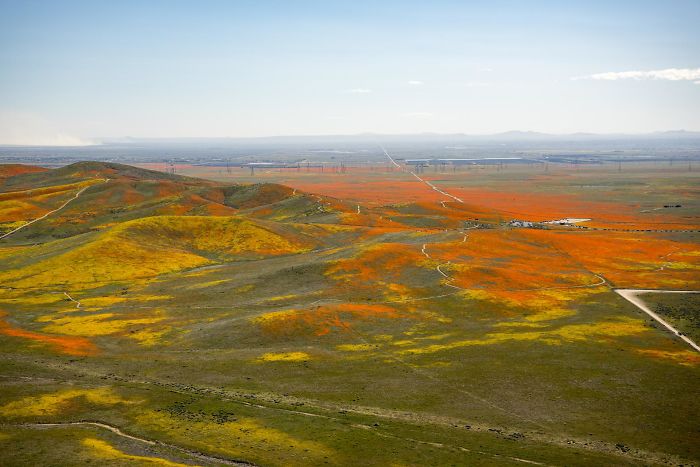
NASA has recently decided to bless our eyes by sharing incredible satellite images of a massive orange poppy superbloom in Antelope Valley California Poppy Reserve. Turns out, the superbloom was so intense in mid-April that it was easily seen from space. boredpanda.com »
As more and more satellites are being launched into space, reflected light from these objects is causing increased sky pollution and issues for astronomers. Now NASA is asking the public for help in monitoring this growing issue, and all you need to do is shoot smartphone photos of the light streaks in the night sky. […] petapixel.com »

China's Longjiang-2 satellite has captured an incredible image featuring both the far side of the Moon and Earth in the background. The data was received by the Netherlands' Dwingeloo Radio Telescope from an amateur radio transceiver built by a team at China's Harbin University of Technology. dpreview.com »
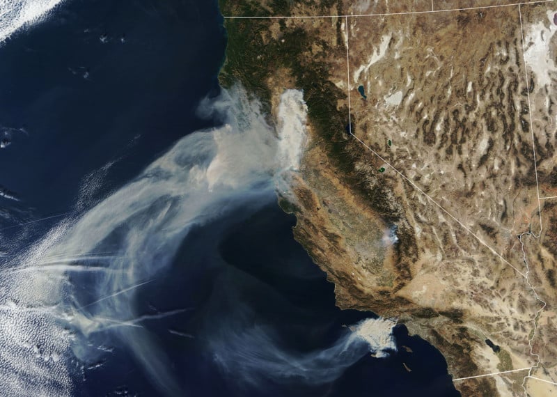
Three major wildfires have been raging in northern and southern California over the past week. NASA has released satellite photos showing the smoke and scale of the devastating Camp, Woolsey, and Hill fires. petapixel.com »
Satellite photos are generally shot straight down at the Earth and make the world look like flat, detailed maps. But shoot satellite photos at an angle, and suddenly they look like aerial photos captured from impossible heights with the world’s longest telephoto lens. petapixel.com »
NASA is looking for people who are willing to regularly snap and share photos of clouds. The space agency is turning to citizen scientists for a cloud observation project that will help validate the images captured by satellites in space. petapixel.com »
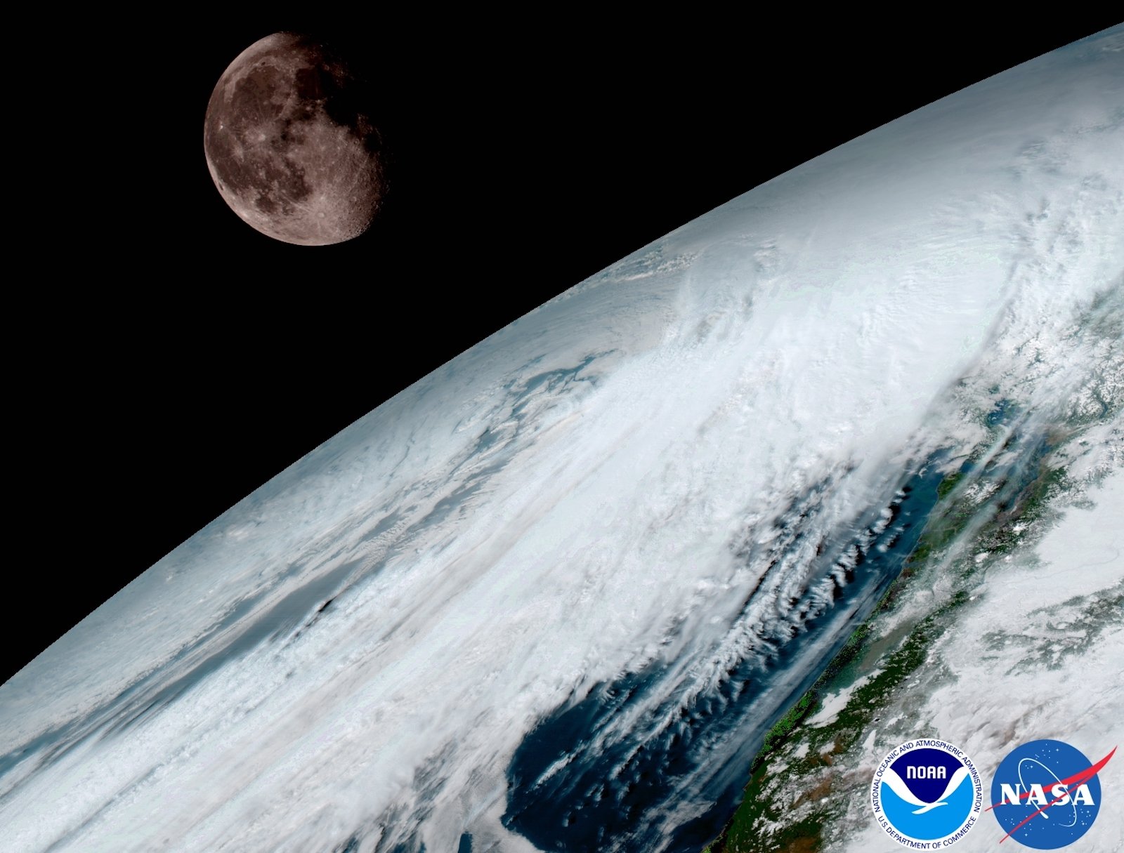
Yesterday, we shared what a total solar eclipse looks like to a weather balloon floating in near space. If you want to zoom out even more, check out this amazing video captured by a weather satellite from outer space. petapixel.com »
NASA has just released a new set of composite satellite photos showing what Earth looks like at night. The gorgeous images feature glowing lights across the planet showing where civilization is found. petapixel.com »

You gotta start somewhere – GlobalXplorer participants' first mission is to look for pits that signal looting. If you've ever dreamed of becoming an archaeologist, you might want to take a look at GlobalXplorer: a browser-based app that trains ordinary citizens to analyze high-resolution satellite imagery for signs of looting and previously unknown sites. dpreview.com »
We're no doubt in some pretty crazy times involving government spying and well as some crazy politics; but a recently declassified CIA document shows us that we've pretty much just always been in those times. thephoblographer.com »
NASA has a new high resolution toy in orbit. The GOES-16 weather satellite was launched from Cape Canaveral back in November, and NASA just published the first photos of our Earth taken by this new satellite and its special “Advanced Baseline Imager. petapixel.com »

Looking for a moment of zen? We suggest spending a couple of minutes playing with Land Lines, a game that draws on Google's satellite images of Earth. So maybe it's not quite a 'game. dpreview.com »

SpaceVR is a startup that is planning to shoot VR cameras into space, so that subscribers to their service back on earth can see the planet from an astronaut's point of view, in full 360-degree VR glory. dpreview.com »